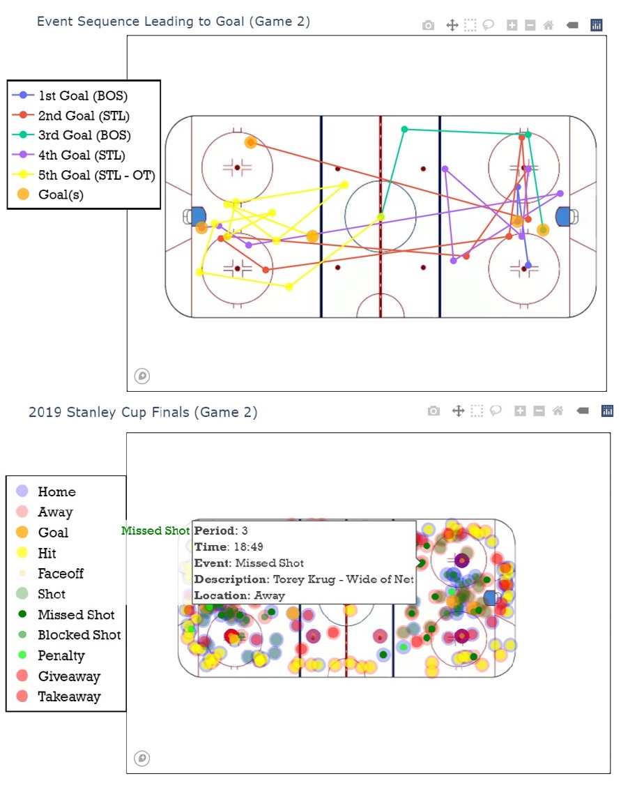
Society argues possession is nine-tenths of the law. Possession generally relates to a specific space-time and place of an object. In ice hockey the puck is the sought-after object of possession. This project will discuss individual zones of the National Hockey League’s (NHL) regulation size playing surface and show the precision with which GIS can display large data sets of ambiguity filtered into descriptive space-time and place of puck possession changes. Since it is inferred that puck possession will eventually change and because it occurs so rapidly within the parameters of ice hockey, previously formed ways of tracking how these changes affect the game are limited. This research will prove that greater insights are now available with the ability to filter large data sets of live and archival in-game events for team managers, coaches, players, fans, and other stakeholders. Methods used here will take into consideration the War-On-Ice model, NHL’s 2018-20 regular season and 2019 Stanley Cup Finals by way of Play-by-Play application programming interface data. Utilizing Python 3.x tools such as Pandas, Plotly and Jupyter Notebook to build a model of space and place applied to NHL statistics will open a window to new data sets of relevance for decision makers surrounding the sport of ice hockey. The intent here is to show how previous methods of displaying puck possession over the entirety of the ice must be narrowed to specific zones depending upon game situation in order to understand relevance of a possession’s space-time and place impact on game play.
-
06 August 2020
-
Professor:
Dr. Jim Thatcher
-
Posted by:
Isaac Van Mechelen