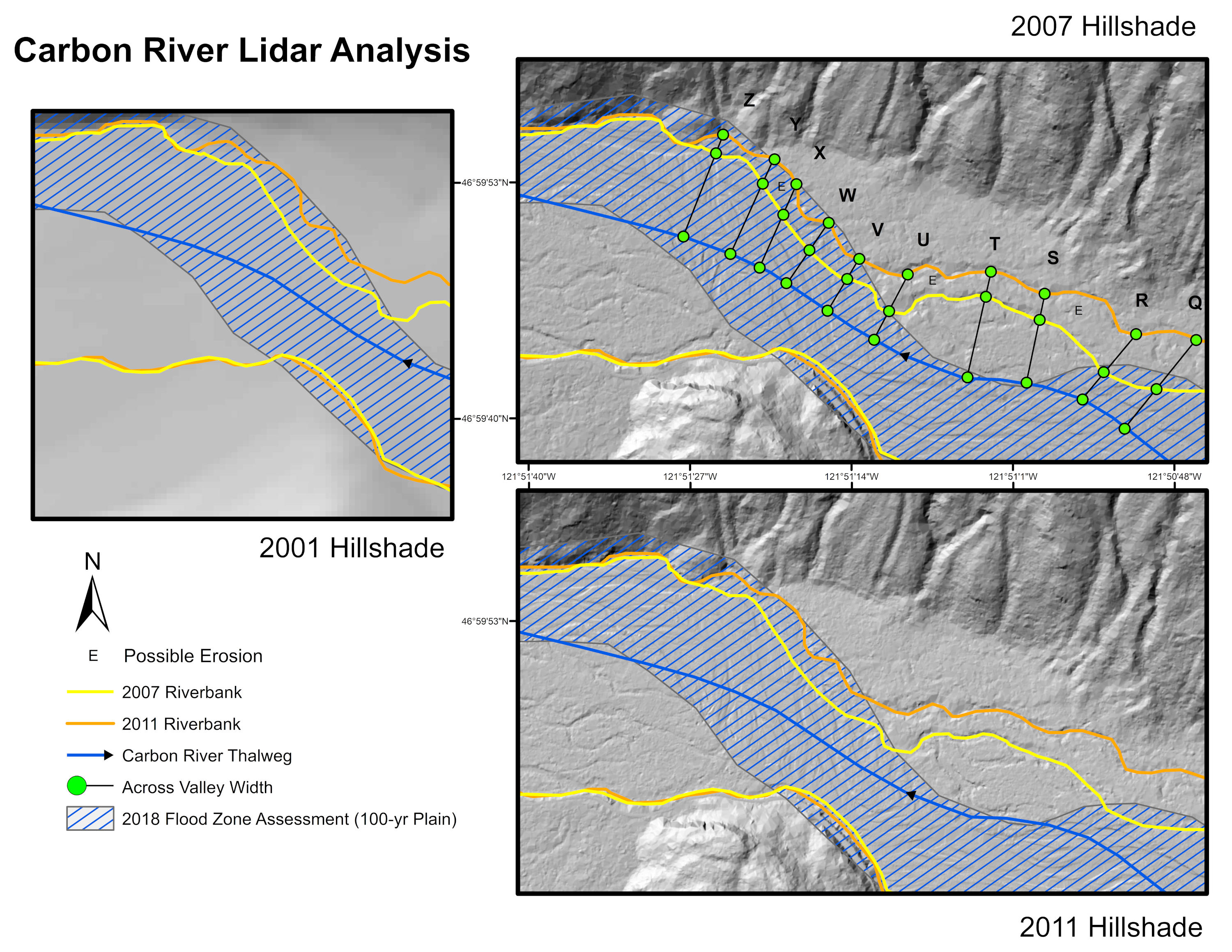
The single most important aspect of this research is to display ecological changes to a rapid and dynamic moving riverbed. Visualizing these changes over a span of significant time suggests that it would offer ease in delivering truly eye-opening data. Therefore, my choice was to go with something that is in constant flux, such as a volcano, glacier, or major inlet.
Since this is close to home and offers insight to my community, I chose the Carbon River, just northwest of Carbon Glacier, the lowest elevation glacier in the contiguous US at around 3500 feet. Carbon Glacier, specifically near the trail head (N 46° 56.744 W 121° 47.441) to reach it’s vaulted suspension bridge, is known for rapid rivers and long hikes.
-
20 May 2020
-
Professor:
Dr. Emma Slaeger
-
Posted by:
Isaac Van Mechelen